NYC’S EAST RIVER TRANSFORMATION
New York (USA), 2011

Location
New York, USA
Promoter
D3, Transportation Alternatives
Result
Exhibited Design – International Design Competition
Year
2011
Design Team
Sergio Bianchi with Valeria Menculini, Roberto Ruggeri, Ivano Ferraro, Kelsey Sawyer
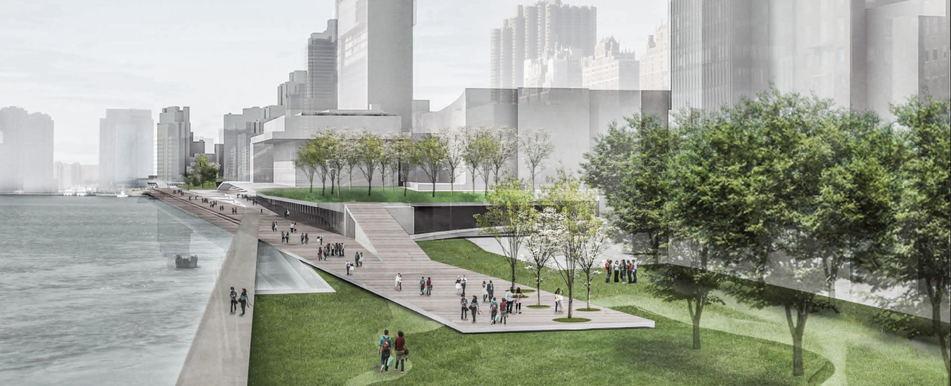
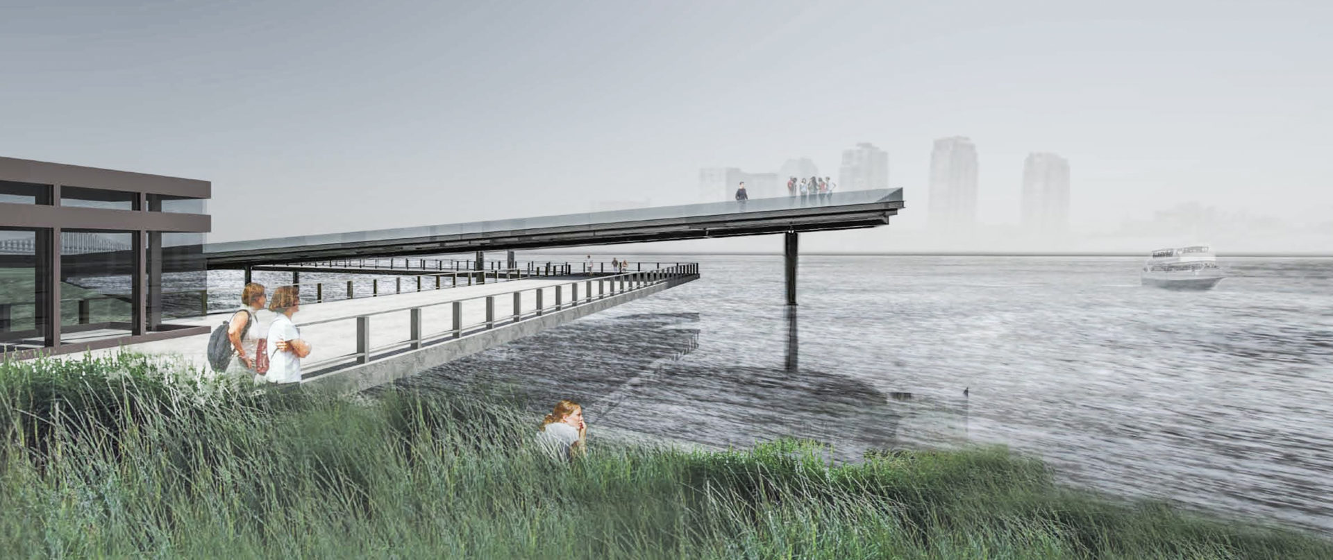
“Close the gap” is an opportunity to investigate various transportation options. The intention is to eliminate the vehicular traffic on the coast. The road goes underground and the recovered surface of the land is made available for walking, biking and roller skating in a safe environment.
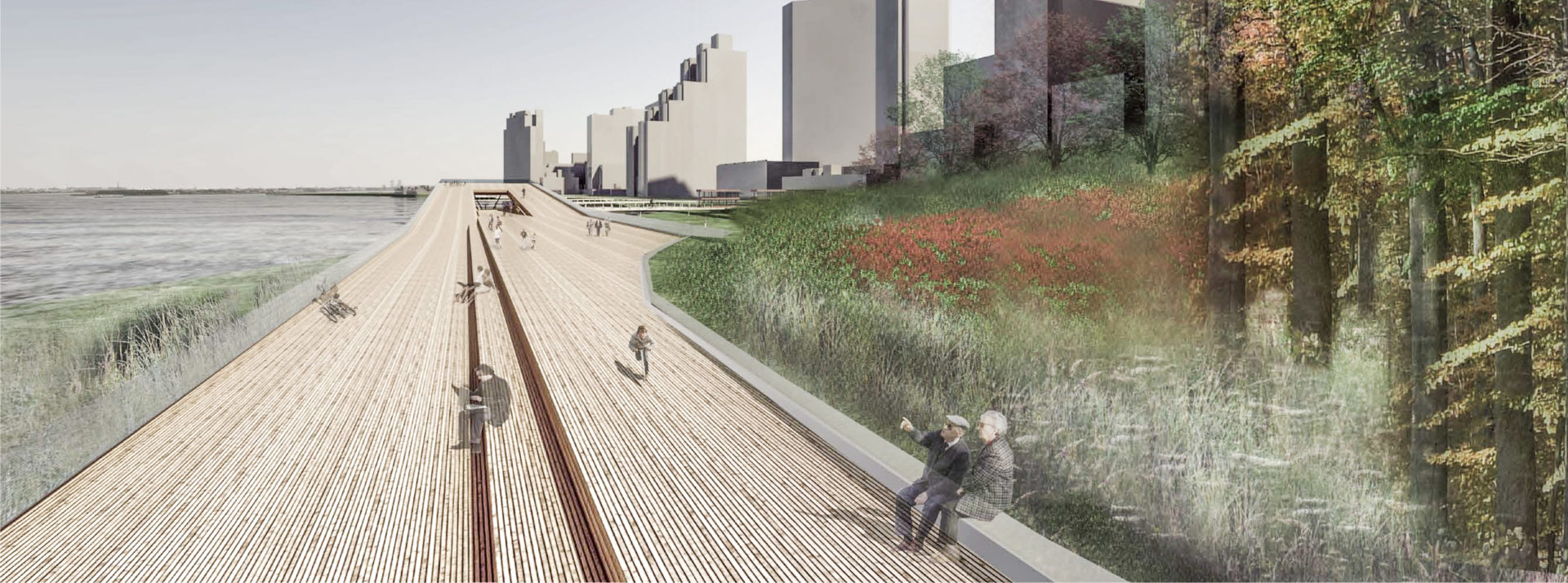
The Native American name for Manhattan was ‘mannahatta’ meaning island of many hills. Today we are witness to an island of many towers, and the original landscape has become invisible. Nature has been virtually confined to Central Park, replaced by an urban jungle.
The theme is how to handle the traffic in order to return the waterfront to nature and pedestrian use.
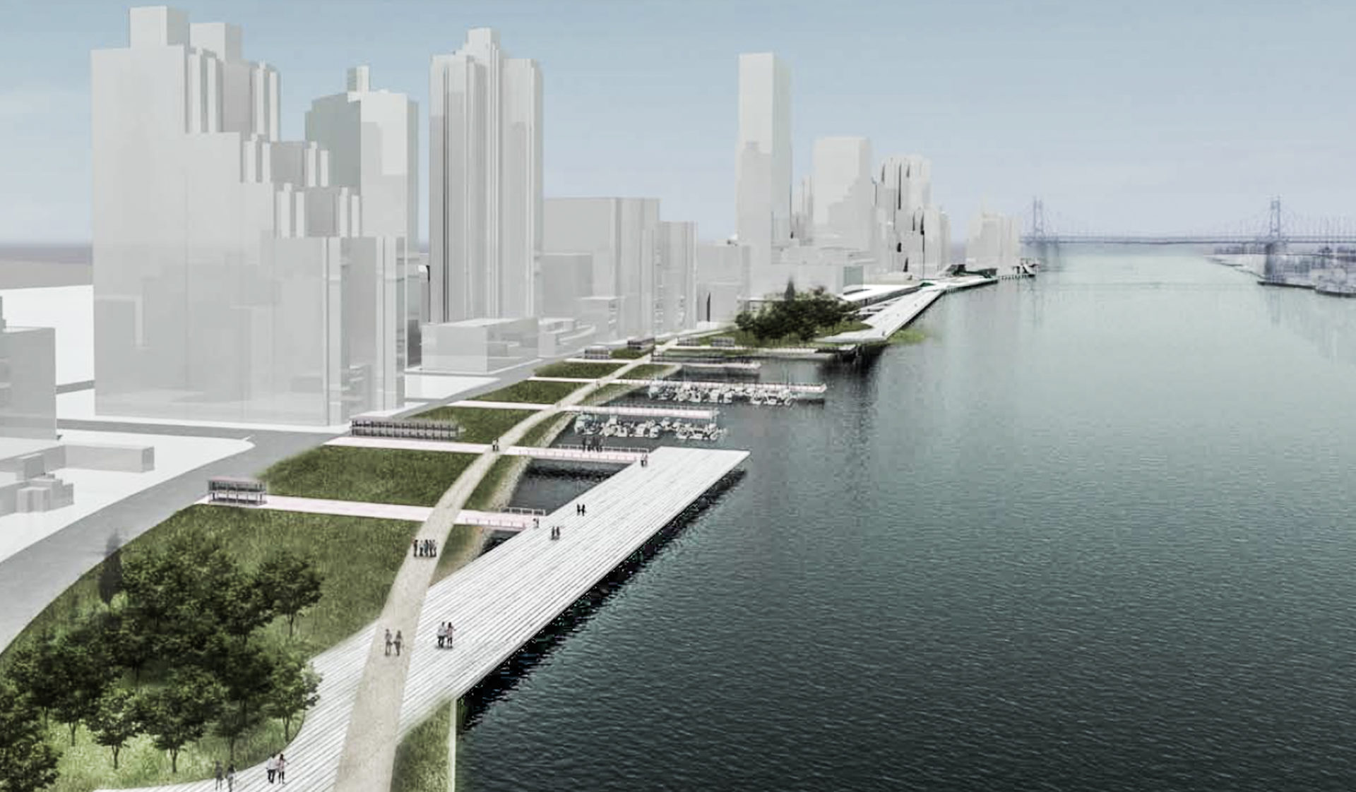
Going from north to south there are three sections with three different strategies.
First section from East 62nd St. to E 54th St. A path, flanked by small green spaces that act as filters between the nearby motorway, is added along the river. As the path reaches East 59th St. it starts ascending to reach Sutton Square in the first of a series of links to the park system.
Second section from East 54th St. to East 41st St. Where the city grid meets the coast, at the end of Sutton Place the situation changes, and FDR Dr. goes underground. Here Sutton merges with the natural and its axis becomes a wooden deck going all the way to 38th Street. The FDR lanes now free from street traffic, accommodate an expansive linear leisure space below the UN headquarters.
Third section from East 41st St. to East 30th St. FDR DR is still underground and the coast is retrofitted as a natural bay. A patch of forest filled with pristine species is restored and people are free to walk or bike in a natural environment.